Home / Waterfalls / Jōfu Falls
Jōfu Falls 常布の滝

| Drop | 70 m (230 ft) |
|---|---|
| Location | Kusatsu, Gunma, Japan |
| Region | Kanto |
| Selected Waterfalls list | No. 26 of the 100 Selected Waterfalls of Japan (Nihon no Taki Hyakusen, 1990) |
| Coordinates | 36.645° N, 138.56356° E |
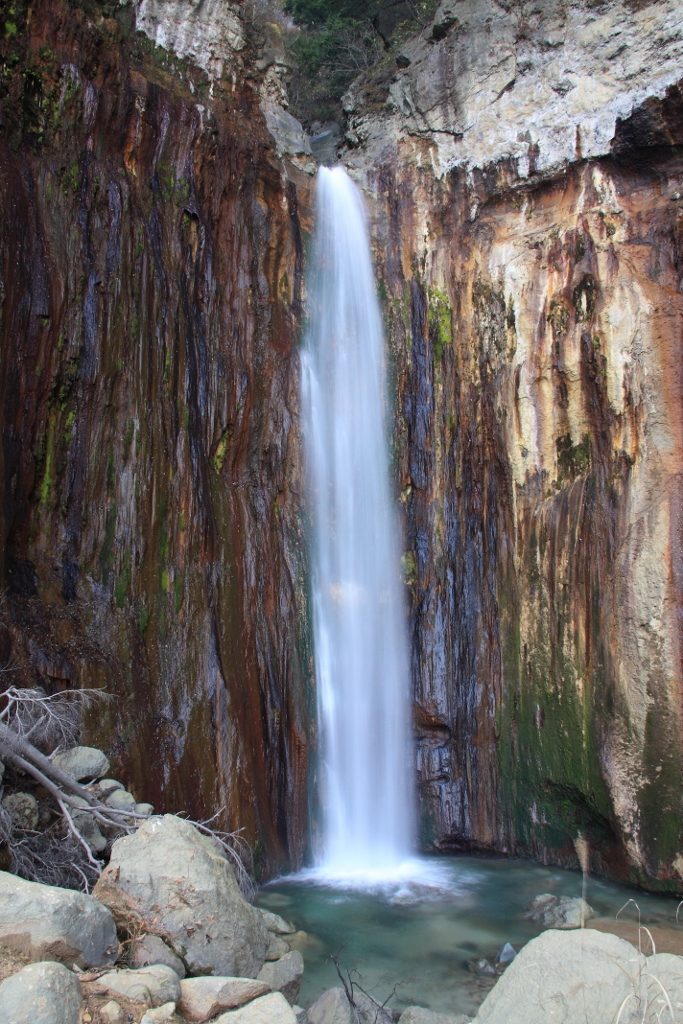
Jōfu Falls is a waterfall in the Tokyo River at GunmaXX158X. One of the the 100 Selected Waterfalls of Japans is chosen. The difference is 70 meters. Rocks and green moss with their distinctive skin and red and black colors create a unique landscape. The top left side of the falls has a hole cut by the erosion and you can see rocks hanging down like stalactite. The waterfall pot is not large, but it's open pretty wide before it. The time of the new green and the red leaves becomes a more visible landscape.
Geological Survey
The strange rock skin, which is also characteristic of Jōfu Falls, has a lot of volcanic influence on Mount White. The vertical structure of the stylus is a condensation limestone that shows the loose stalagmite and is a layer of pygmy and volcanic ash called the white float stream. The top of the falls is a new layer of earth in the new age lava called root lava.
Jōfu Falls hypothermia
During the hike trip from the observation deck to Jōfu Falls, there is an unknown waterfall in the front, but under this waterfall, there is a hot spring called Jōfu Falls. What's called wild water. The Pocket Park, set up in a hot - water spot below the waterfall, will be won once-in-a-lifetime.
Traffic access
(about five minutes in a car from the hot spring of Toshizu.) It would be advisable to park in an international ski lot or in a parking lot in Mt. Fuji's sixth. We need to be careful that we can't go along a forest road from the Tohoku border, which is about 12 miles [1.7 km] from Mount Shira to the Fukuoka. (There is a path on our right hand to the forest road, about 5 minutes by car, and 25 minutes by foot, and so on.) In the case of a car, there's a hairpin curve on the way, so you park your car on the side of the road before you. If you walk about 15 minutes from here along the forest road and double the hairpin curve, you'll have a Jōfu Falls platform ahead of you and you'll be able to get from here. If you walk about 30 minutes on a hike course from a little back from the observation table, you will be able to get out before the falls. You need to be careful because the hike course is just part of the tread and part of the area where bears come from. However, because of the danger of falling rocks on the hike, they have been closed since September 2014.
Text adapted from the Japanese Wikipedia article 常布の滝, whose full text was translated into English for this guide by its contributors, licensed CC BY-SA 4.0. Drop and location facts cross-checked with Wikidata (CC0) and the 100 Selected Waterfalls of Japan list (Japanese Wikipedia, CC BY-SA 4.0).